Earthquake faults
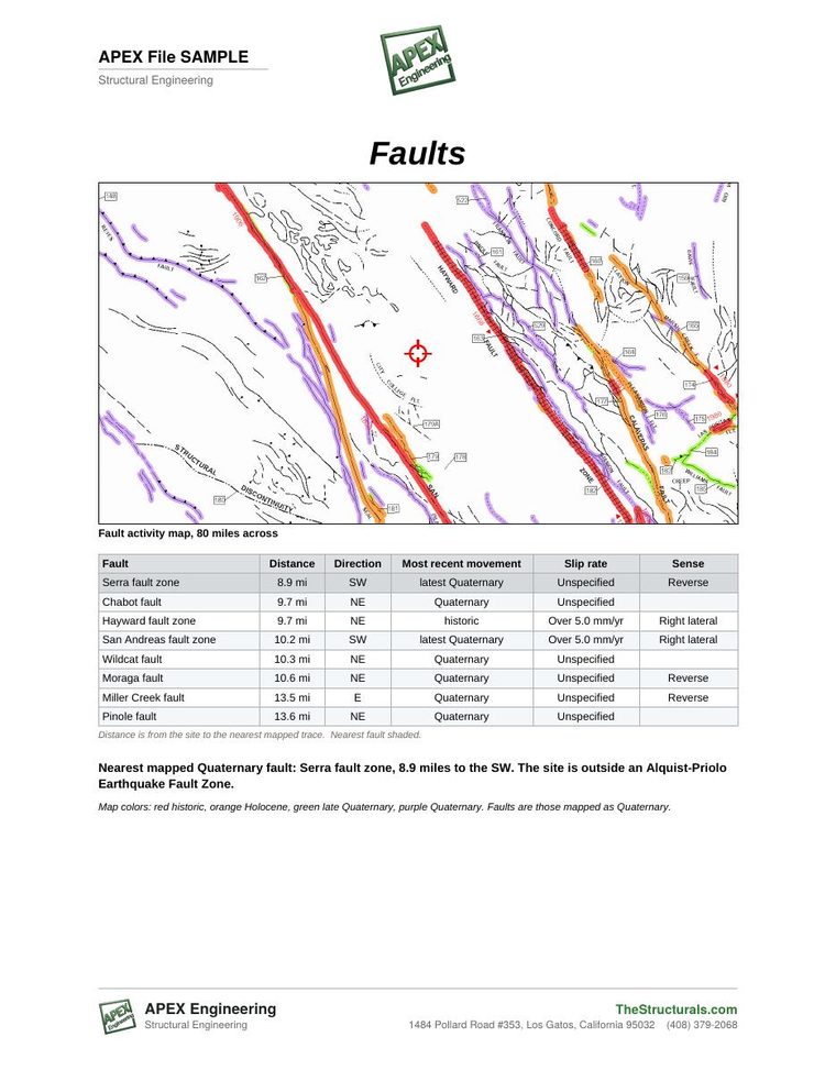
Every mapped fault near the address from the U.S. Geological Survey fault database, drawn on a map, with the nearest faults named and the distance to each.

Site specific hazard report by address
Send an address, residential, commercial, industrial or solar. APEX Engineering returns a report of the natural hazards at that site: the earthquake faults nearby and how far away they are, the seismic shaking the site is designed for, liquefaction, landslide and tsunami zones, wind, snow, flood zone and soils, with aerial and street views. Prepared by a licensed Professional Engineer from the same public hazard data used to design buildings.
Before you begin
Know your structural site data before you begin. Do you need the seismic values, the wind values, the earthquake hazards, the flood zone or the geotechnical data for the site? This report gathers them for the address, so the design starts from the right numbers.
Design criteria
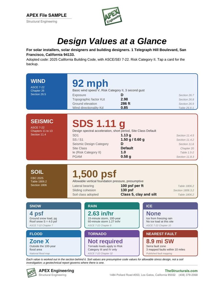
The page behind the index gives the wind, seismic and soil bearing values for the site, per the adopted code, with the code section beside each value: wind speed, exposure and topographic factor; SDS, SD1, Site Class and Seismic Design Category; the presumptive allowable soil bearing, lateral bearing and sliding values; and the ground snow load. Find the number at a glance, then tap a card for the backup.
Sample report
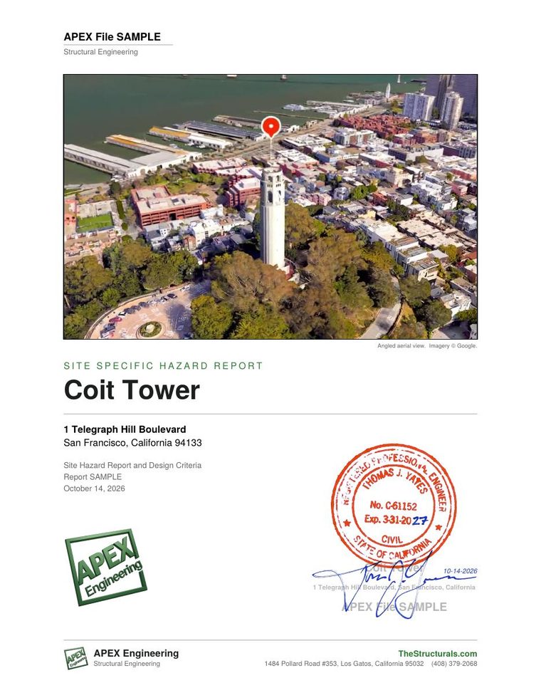
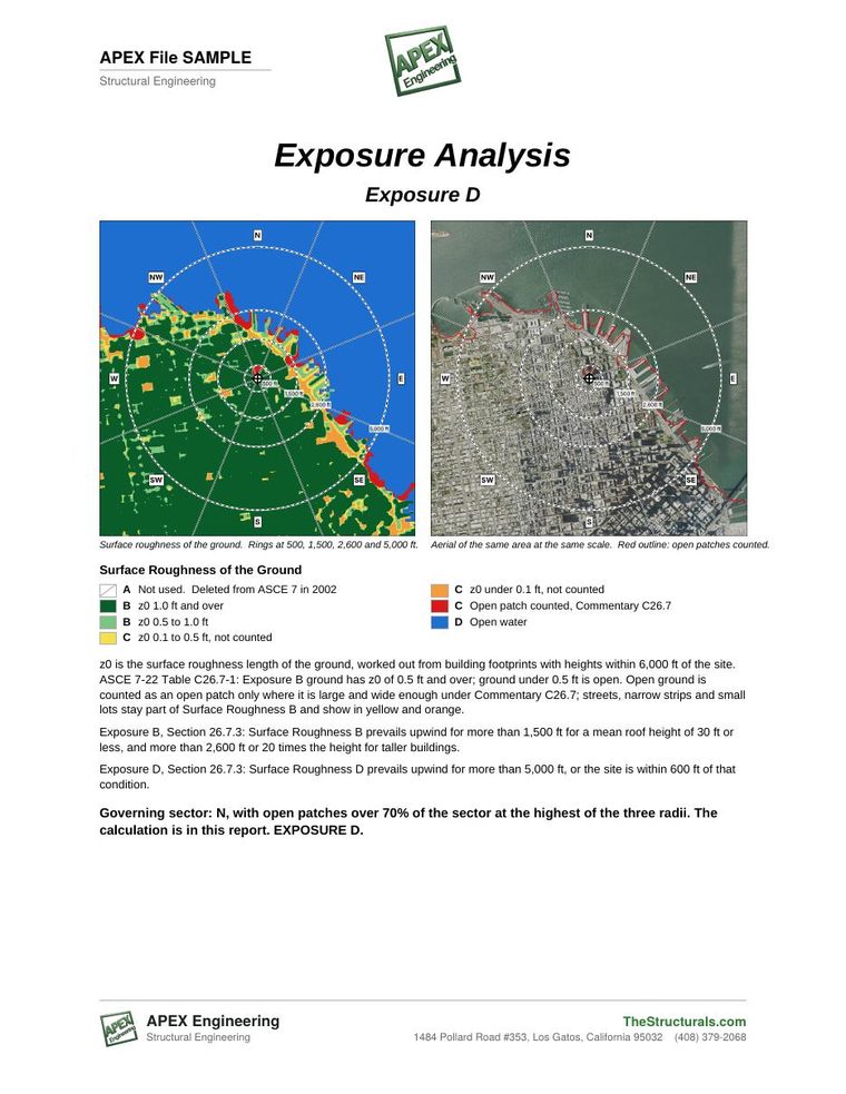
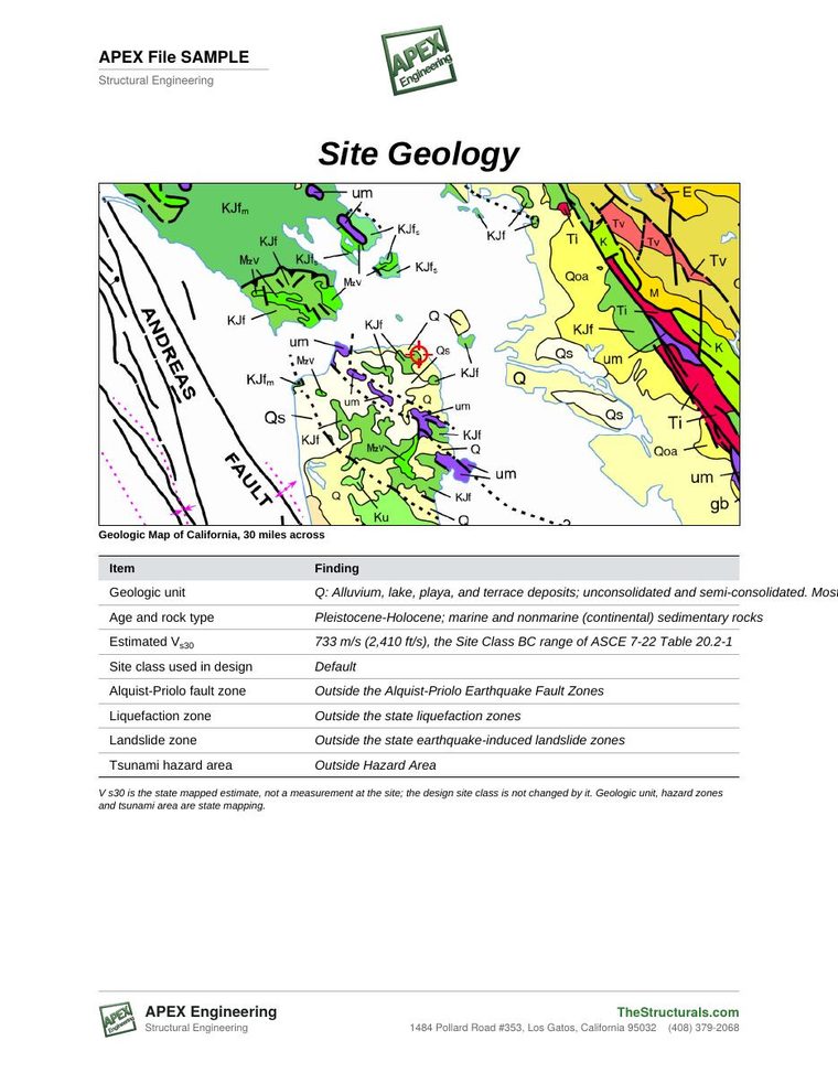
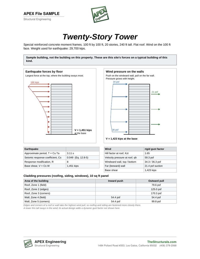
Pages from a sample report for Coit Tower in San Francisco. Tap a page to see it full size, or open the whole sample report.
The report
Each hazard is mapped, its value for the address is stated, and its source is named, in one PDF.
Every mapped fault near the address from the U.S. Geological Survey fault database, drawn on a map, with the nearest faults named and the distance to each.
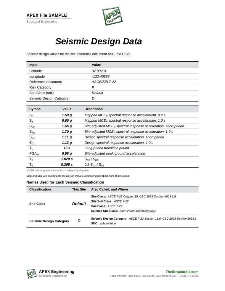
ASCE 7-22 ground motion for the address: Ss, S1, SDS, SD1 and the seismic design category, the values used to design new construction there.
Whether the address is inside a mapped liquefaction or landslide zone, where the state has mapped them.
Whether the address is inside a mapped tsunami hazard area on the coast, where the state has mapped one.
Basic wind speed, exposure from the land cover around the site, the hill effect from ground profiles in eight directions, and tornado data.
Ground snow load and ice thickness for the address and its elevation.
The FEMA flood zone at the address and the flood map around the site.
The mapped soil under the site from the national soil survey, including shrink-swell clay where it is mapped.
Aerial views from four directions and from above, and street views of the property.
Who orders it
Wind, seismic, snow and soil bearing values for the array and its racking, with the code section beside each value.
The hazards at a plant, warehouse, office or campus before a purchase, an expansion or new equipment on the roof.
One engineer-prepared summary for every building in a portfolio, for capital planning, insurers and lenders.
Earthquake, flood and wind exposure of the site, for emergency planning, retrofit priorities and tenant questions.
The site's design criteria before the first drawing, so bids and schedules start from the right numbers.
The site values gathered in one document, stamped where the permit calls for it.
Know what is under the site and nearby before the contingency period ends, or before a retrofit.
A clear summary of the hazards at the address to hand a client with a disclosure or underwriting packet.
Questions
The report maps every fault in the U.S. Geological Survey Quaternary Fault and Fold Database within reach of the address, names the nearest faults and gives the distance from the site to each one.
The report lists the ASCE 7-22 ground motion values for the address (Ss, S1, SDS and SD1) and the seismic design category that follows from them, the same values an engineer uses to design a new building there.
Where a state has mapped these zones, the report states whether the address is inside one. California maps them through the California Geological Survey; where a state has not mapped a zone, the report says so.
The report gives the basic wind speed, the wind exposure worked out from the land cover around the site, the hill effect (topographic factor) from ground profiles in eight directions, the tornado data, the ground snow load and the ice thickness.
The report shows the FEMA flood zone at the address and the flood map around it.
No. The report is an engineer's summary of published hazard data for the address. It is not a site visit, a building inspection, a structural evaluation or a geotechnical investigation, and it is not a California Natural Hazard Disclosure statement.
Yes. The report is sealed and signed by a licensed Professional Engineer in Arizona, California, Colorado, Florida, Nevada, New York, Oregon, Texas and Washington, with the design wind, snow and seismic values certified for the address. In other states it is issued without the seal.
Every report carries its own report number. Call APEX Engineering at (408) 379-2068 with the report number in hand to have a specific concern about the structure addressed.
Free site report
Enter the property address and your email. APEX Engineering prepares the report and sends it to you.
Scope. The report is an engineer's summary of published hazard data for the address. It is not a site visit, a building inspection, a structural evaluation of any building or a geotechnical investigation, and it is not a California Natural Hazard Disclosure statement. Zones are reported where a public agency has mapped them.